
• CMMI Maturity Level- 5
  • ISO 27001 INFORMATION SECURITY
  • ISO 14001 ENVIRONMENTAL MANAGEMENT SYSTEM
  • BS OHSAS 18001 HEALTH & SAFETY MANAGEMENT SYSTEM
  • ISO 9001:2015 (Quality Management System for Standards)

    Geospatial World

    The concept of being a one-stop-solution for all geospatial needs in 2D/3D Mapping and Engineering. We provide high end geospatial solution and services for clients and companies in public and private sectors across the world.

    View More

    Photogrammetry & Ortho Photo

    View More

    Ortho Photo

    View More

    Hydrology Survey & Water Resources Services

    View More

    Value-Added Digital Services

    Spatial & Digital Solutions Advanced GIS, 3D Modeling, Digital Twins & Visualization. Intelligent Technologies AI, Machine Learning, Remote Sensing, Drones & IoT. Smart Platforms & Services Web, Cloud, Mobile & Enterprise Digital Solutions.

    View More

    LiDAR

    View More

    MOBILE LiDAR

    View More

    Geophysical surveys

    Geophysical surveys investigate underground conditions using advanced technologies. They support groundwater, mining, infrastructure, environmental, marine, and renewable energy projects. Accurate subsurface data improves project planning, safety, and decision-making.

    View More

    Geotechnical Investigation

    Geotechnical Investigation & Testing Services include site investigation, drilling, soil and rock testing, foundation testing, and laboratory analysis. These services help evaluate subsurface conditions, material strength, foundation performance, and construction quality.

    View More

    BIM

    Green World Soft Tech is offers high quality Architectural construction drawings, HVAC, MEP BIM Co-ordination, Revit family creation and Point cloud to BIM Modeling services.

    View More

    Environmental

    Our services include EC, FC, CRZ, Wildlife Clearance, Aviation NOCs, and Pollution Control Board approvals. Using GIS, DGPS, drone surveys, scientific analysis, and laboratory testing, we support compliance and environmental protection.

    View More

    WHO WE ARE

    Green World Soft Tech is an International leader providing in Geospatial Solutions and Data Management Services, Operating from cosmopolitan city Chennai India. Green World Soft Tech is committed to maintaining the partnership with our clients and building new business development initiatives by delivering customized, high-quality solutions in an affordable and timely manner.
    • OUR MISSION
    • OUR VISION
    • OUR VALUE

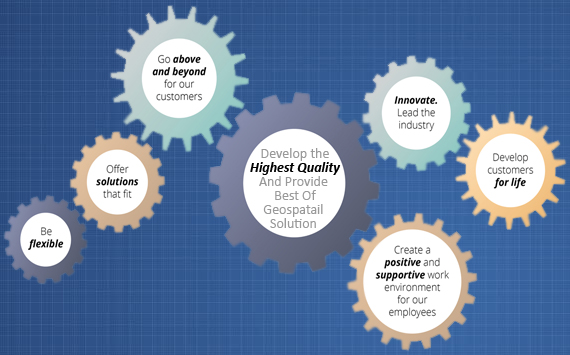
    Green World Soft Tech provides professional geospatial services in strict adherence to the highest ethical and technical standards. We understand that each of our client's needs are unique, however, they all require timely, technically sound and cost-effective solutions.Our standard business practice is to work with each client to clearly define project scope and requirements and develop a solution that is right on target.

    We assist our clients through GIS, Remote Sensing, and other related geospatial consultancy services including tools for the most suitable solutions in modelling, planning, designing, executing, monitoring, and managing projects and resources across geographical space. Our areas of expertise include forestry, wildlife, fisheries, wetlands, and geospatial services.Our work is characterized by the highest level of client service, the application of the best science and technology, quality processes and results, our integrity, and our respect for the natural environment.
    READ MORE ABOUT US

    "Societal Sustainability is the fruit of Futuristic Imagination"

    To offer universal and innovative solutions for integrating spatial information into the systems and processes of organizations. To be considered among the premier engineering, design and geospatial data processing service companies in the energy, oil and gas, forestry, Pipelines ,Urban and rural planning, Agriculture, Fishery, coastal management, Minings,Water Management,Telecom Networking,Cad Engineerings,DBM and Transportations industries by our customers, competitors and agencies. We strive to maintain and promote the proper balance between safety(in House & Field Survey, Production), quality and commercial performance while people and the environment remain our most valued and highest concerns.
    READ MORE ABOUT US
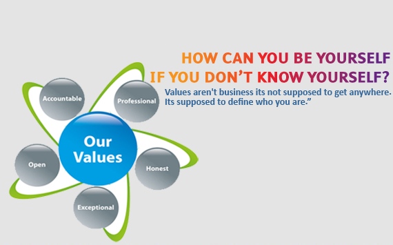
    Our core values are SERVICE, INTEGRITY & EXCELLENCE. We live these every day in how we work together, stay true to our mission and pursue our vision. These core values represent our commitment to, and continuation of, the following principles which have evolved since the founding of our firm:
    • Ethics: We demonstrate qualities of integrity, responsiveness, and professionalism.
    • Safety:We take the appropriate measures to ensure a safe work environment for(In-House & Field Survey) ourselves and our clients.
    • Solutions: We are committed to technical excellence and innovative solutions to achieve our client's objectives.
    • Teamwork: We are an organization of team players, each contributing by doing the work essential to our success and growth.
    • Productivity: We perform work in the most cost-effective and productive manner to ensure the financial success of our clients and company.
    • Pride: We take pride in our company accomplishments and endeavors.
    READ MORE ABOUT US

    HOW CAN We Assit You With Our Services

    We are providing services in Digital Photogrammetry, LiDAR, Mobile LiDAR, ORTHO, GIS, CAD, PLS CAD, BIM, Remote Sensing, Total Station/DGPS Survey and UAV(DRONE Survey) etc.. Our Services are Quality assured, Timely Executed with an affordable competitive pricing.
    01

    DIGITAL PHOTOGRAMMETRY

    The input to photogrammetry is photographs, and the output is typically a map, a drawing, a measurement, or a 3D model of some real-world object or scene.
    02

    LiDAR / MOBILE LiDAR

    Use of LiDAR or mobile lidar for topographical mapping and contour generation is fast gaining acceptance worldwide.
    03

    GIS

    GIS is the go-to technology for making better decisions about the location. Making correct decisions about location is critical to the success of an organization.
    04

    CAD

    CAD has commonly used in the field of architecture, MEP or structural engineering. It can help you to explore design ideas, visualize concepts through photorealistic renderings and simulate how a design will perform in the real world.
    05

    UAV / DRONE

    As specialists in UAV surveying and mapping, we are changing the face of professional surveying. We collect, analyze, and distribute aerial data quickly and cost-effectively than ever before.
    06

    SURVEY

    The map is the essential piece of equipment which the geographer, engineer, and architect use, and their training are said to be incomplete without instruction on procedures of map making where surveying is most important.
    07

    Geophysical

    `Specialists in Geophysical Surveys - GPR, VES, Seismic & Magnetic. We deliver reports & maps for groundwater, utilities, and site investigation.
    08

    Geo technical

    We provide comprehensive Geotechnical Investigations Including Borehole Drilling, SPT, CPT & Laboratory Testing. Our data-driven reports help architects and engineers design safe, cost-effective foundations.
    09

    Hydrology survey

    We provide detailed hydrology surveys to assess surface water, groundwater, and drainage patterns. Our studies support water resource management, flood risk assessment, and sustainable project planning.
    10

    Environmental clearance

    We assist with Environmental Clearance for projects as per MoEF&CC and State norms. Our team handles EIA studies, documentation, and regulatory approvals for smooth project clearance.
    11

    Mining survey

    we specialize in Mining Related Services. We assist with Geophysical Survey, Drilling, Groundwater Study, Drone Mapping, and EIA-EC for mines & quarries.

    ARE YOU READY TO Join Our Team?

    We will provide you platform to utilize your skill and knowledge effectively and you will get a chance to work with us. It will be the best opportunity for improving your knowledge and skills.